|
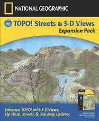
National Geographic Topo! Streets & 3-D
Views
Expansion Pack
Not
required for New Release
|

|
$19.95
|
|
|
What is the TOPO! Streets and 3D Views Expansion
Pack?
The TOPO! expansion pack is a must have software
product for anyone interested in having the very best topographic
maps available Simple, easy to use, application. Works with all 50
states.
What does the TOPO! Streets and 3D Views Expansion
Pack do?
The TOPO! Expansion pack allows any
state series user
to:
- Better understand the terrain before heading out by
viewing the maps in a 3-D perspective
- Improve users ability to understand where they are
and where they are going by updating maps with 2004
Streets and Roads
- Insures that users have the latest quad maps,
functionality and information from National
Geographic via the live update feature
- Use TOPO! with the latest GPS receivers by providing
support for USB cables
The TOPO! Streets and 3D Views Expansion Pack
distinguishes TOPO! from our competitors because:
- Only topographic map software to offer 3-D fly
through mode.
- Draw your route on the map and TOPO! creates a movie
showing you what your hike is going to look like
- Only topographic map software to combine up-to-date
streets and roads with actual topographic maps. Other
products have inferior road database with less
streets, roads and highway information combined with
inferior topographic maps that do not have all the
information of an actual USGS map.
- TOPO! is the easiest to use map software. Expansion
pack gives users the advanced functionality they want
while maintaining TOPO!'s award winning ease of use
Who should buy the expansion pack?
- Anyone who is interested in having the very best
topographic map available.
The combination of up-to-date streets and roads with
the latest actual USGS quads results in a fundamentally better map experience.
- Excellent add on sale for new customers who want a
TOPO! state series product plus the functionality of the expansion pack.
- Perfect for existing state series customers who want
to add 3-D, updated streets, and quad maps.
3-D Views and Fly-Thru
Look down the valley, or stand on top of a mountain
and "look" around to see
the views.
TOPO!'s 3-D Viewer and Animated Fly-Thru
enable you to fly along
the trail you've drawn as it winds and climbs to your destination.
You can even stop anywhere along the trail and zoom and pan to see
the view. Resizable split screens make it easy to expand any screen
for better viewing.
Updated Streets & Roads
With TOPO! Streets & 3-D Views you can easily lay an
updated road network on
the 1:24,000 and 1:100,00 scale USGS TOPO! maps. From superhighways
to forest roads, TOPO! Streets & 3-D Views gives you the confidence
to find your destination in any of the 50 states.
GPS USB Support
TOPO! Streets & 3-D Views has the latest connectivity
built-in to enable you
to use your TOPO! software with the newest GPS
receivers.
Live Map Updates
Get the latest USGS quad maps and updated roads for
any of the TOPO! state products.
Live Map Update automatically searches your
defined area to see if
something new is available, and gives you the tools
to quickly download new
information to replace older quads and roads.
TOPO! Expansion Pack is
not Macintosh compatible and
requires a
TOPO! State
product to function.
WINDOWS System Requirements
Windows 98, 2000, ME, & XP; DirectX version 9
(included);
8MB+ video card that is DirectX 9 compatible is
required for 3D views.
Supported GPS Receivers
Works with most popular handheld receivers
manufactured by Garmin, Eagle,
Lowrance, and Magellan. Requires a serial or USB
cable (sold separately).
|