|

|
Overview
More Info
Sample Maps
System
Requirements
|
|
All Topo Maps by iGage
Now you can purchase every
1:24,000 7? Minute; every 1:100,000 (most states) and
every 1:250,000 scale USGS Topographic Map in high
resolution and a full featured viewer for $70 to $120 a
state depending on the state. That is about 3 cents a
map!
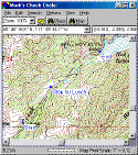
Each state's collection is fully searchable by place name, Township/Range (available for most states), map name and location. All Topo Maps will convert Lat/Lon and UTM coordinates to annotated map locations. The All Topo
Map: GPS Tool makes uploading and downloading waypoints, routes and trackpoints to your GPS easy. Real Time Tracking displays your current position on the map as you drive.
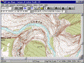
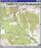
Lightning fast, full-featured viewing software allows instant map selection using the built in place name database, zooming to any scale, instant coordinate display, straight line, traced distance measurements and printing
at any scale both in color and black & white.
Entire maps or viewed portions of maps may be copied to the clipboard as bitmaps (and manipulated) or directly printed. Maps may be directly exported to .TIF and .TFW worldfile formats for use with CAD and GIS applications.
|